Catégorie
Orientation
Licence
Couleur
Âge
Nb de personnes
Collections
Période
30 résultats pour : world map
Page sur
/
1
Connectez-vous pour plus de résultats
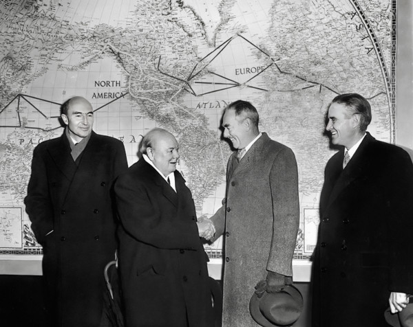
GLS26A01_413
British Prime Minister Winston Churchill (left cen...
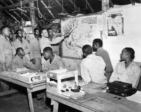
GLS25A01_180
Members of U.S. 477th Anti-aircraft Artillery, Air...
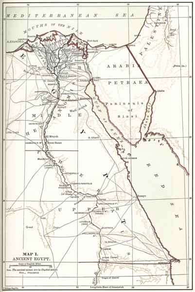
GLS22A06_447
Map I
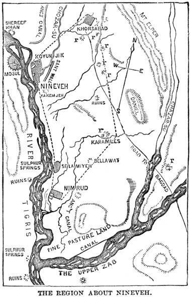
GLS22A06_464
The Region About Nineveh
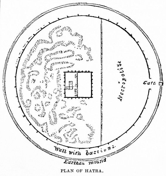
GLS22A07_003
Plan of Hatra
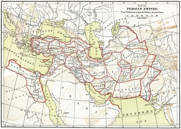
GLS22A06_490
Persian Empire Map
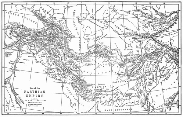
GLS22A07_001
Map of the Parthinian Empire
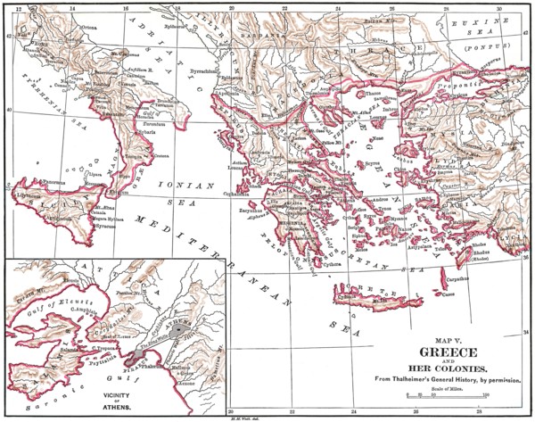
GLS22A07_028
Map V
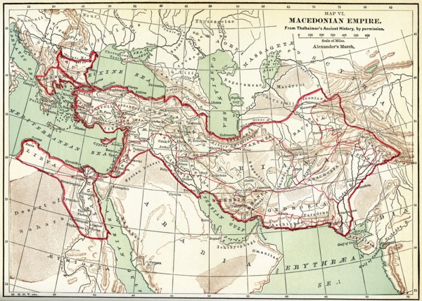
GLS22A07_038
Map VI. Macedonian Empire
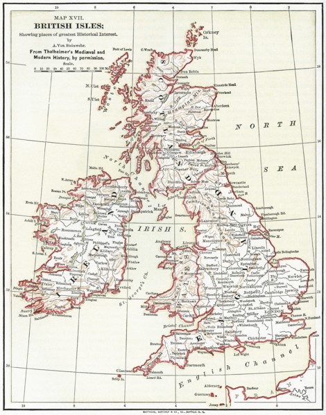
GLS21A00_075
Map XVII
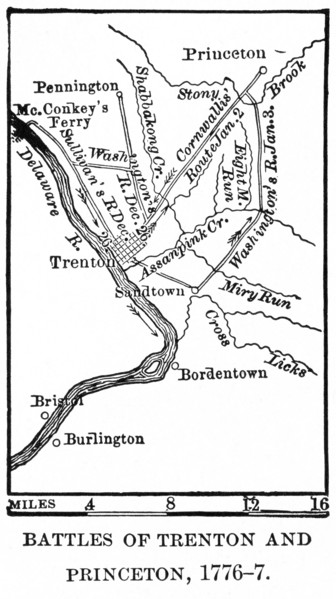
GLS21A00_238
Battles of Trenton and Princeton
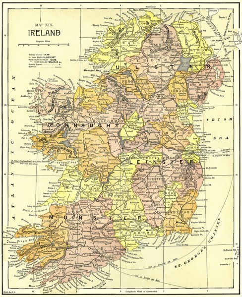
GLS21A00_089
Map XIX
GLS20A04_113
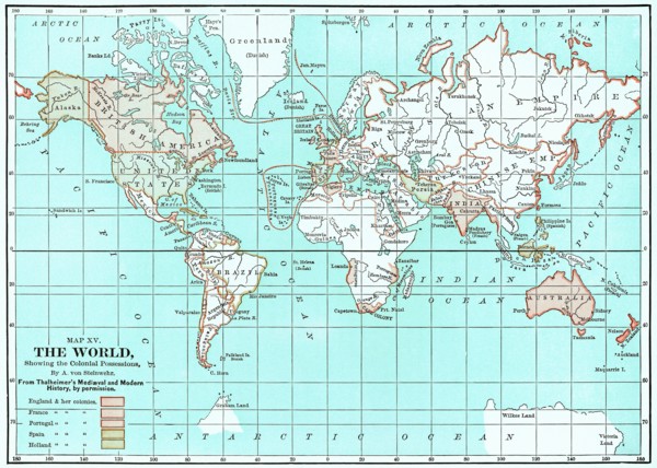
Map XV

GLS20A04_054
Map XIV showing the progress of Geographical Knowl...
GLS20A04_053
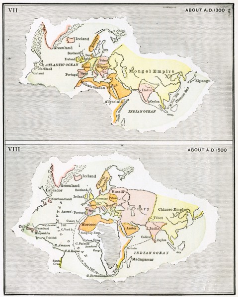
VII Map of Europe
GLS20A04_038
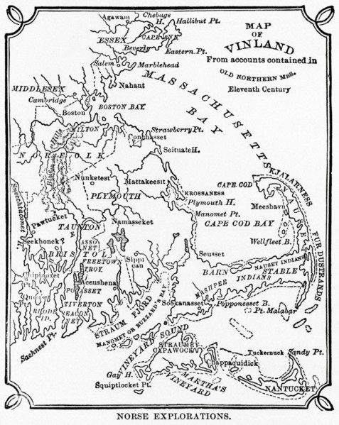
Norse Explorations
GLS20A04_128
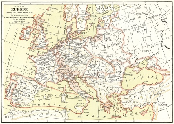
Map XVI
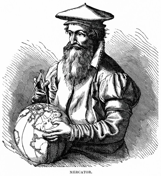
GLS20A04_052
Gerardus Mercator
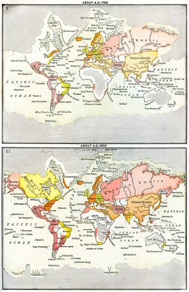
GLS20A04_055
X Map of the World about A.D. 1700
GLS20A00_034
military, officers, headquarter, American, WWII, W...
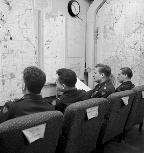
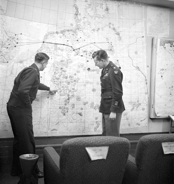
GLS20A00_035
military, officers, headquarter, American, WWII, W...
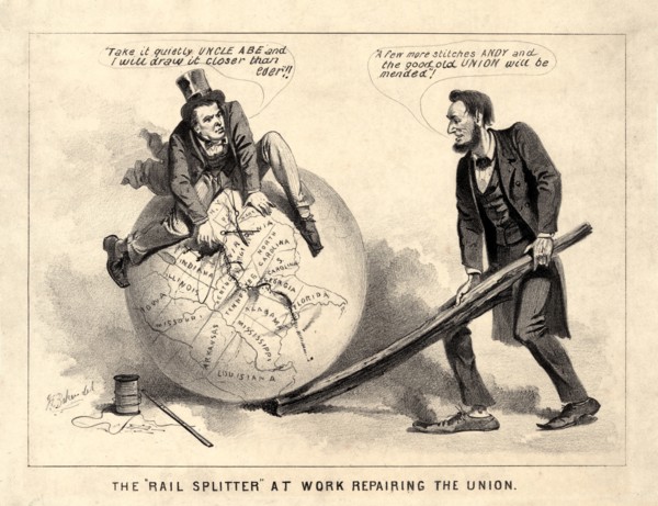
GLS19A06_106
The "Rail Splitter" at Work Repairing the Union", ...

GLS19A04_443
Man with Globe

GLS19A04_444
Man in Suit with Globe
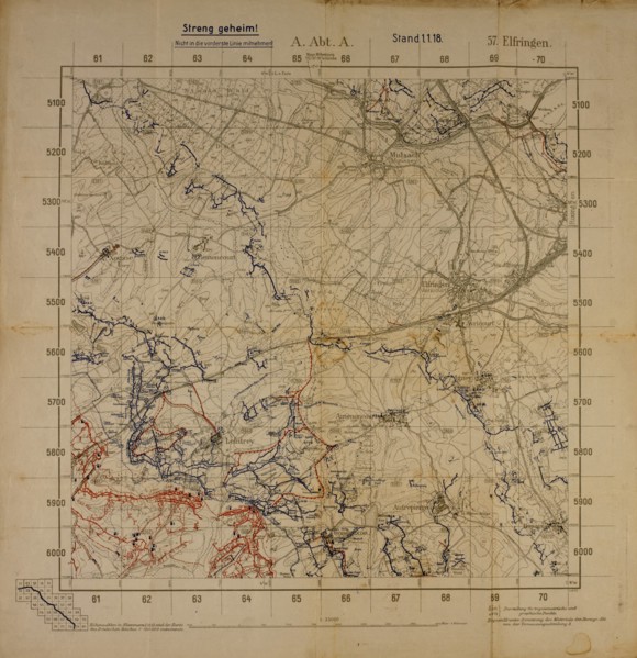
GLS18A29_064
Top Secret World War I Map of Northeastern France ...
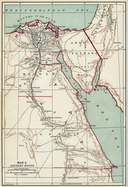
GLS18A31_303
Map of Ancient Egypt, Illustration, Cyclopaedia of...
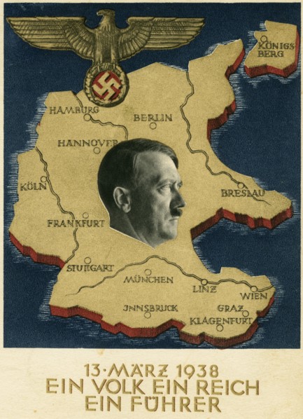
GLS18A19_226
Adolf Hitler Portrait on Map of Germany and Unific...
GLS18A07_054
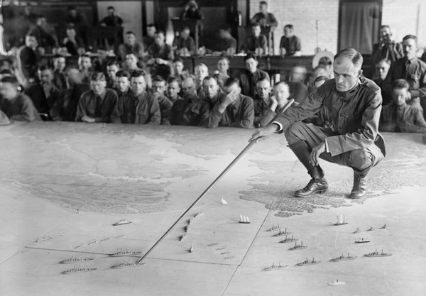
U.S. Military Training during World War I, Harris ...
GLS18A06_046
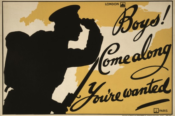
Silhouette of Soldier Looking at Map of United Kin...
GLS18A04_498