604 résultats pour : coastline
- Page
-
- sur
- 7
Connectez-vous pour plus de résultats
HRM19C02_475
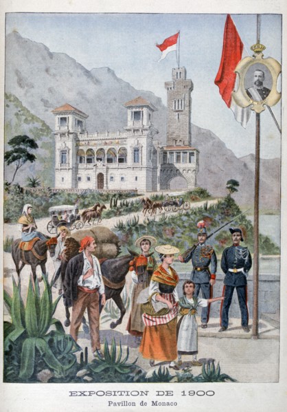
The Monaco pavilion at the Universal Exhibition of...
HRM26A15_020
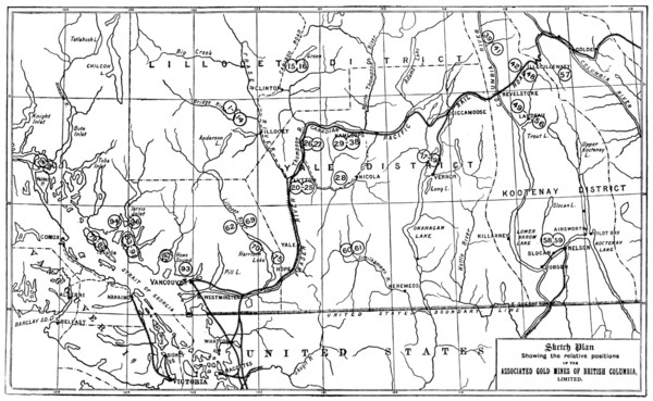
Gold in British Columbia: plan of the associated g...
HRM26A15_159
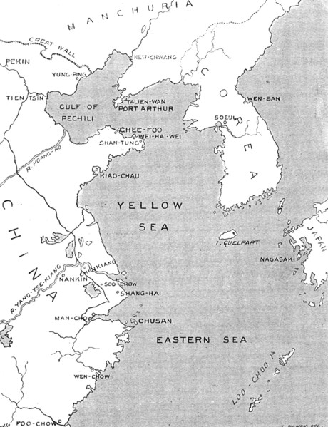
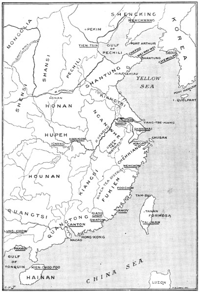
The Chinese Question: map showing positions of chi...
HRM26A14_263
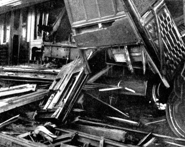
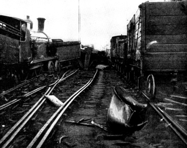
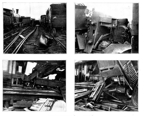
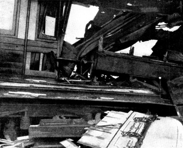
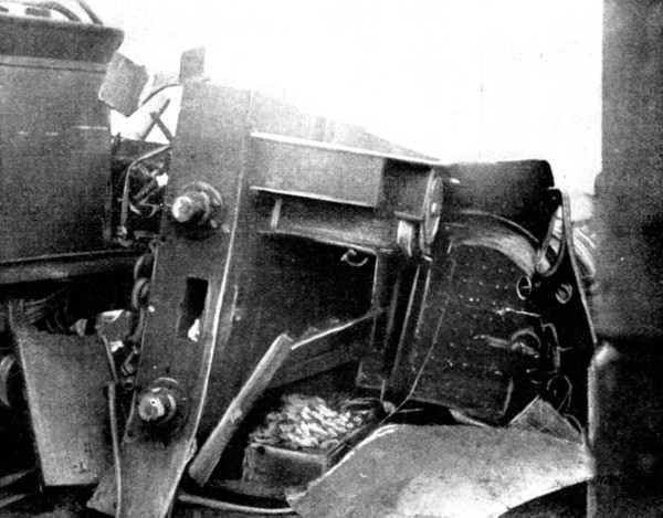
The accident to a Scotch Express, 1898. Creator: W...
HRM26A14_274
The Chinese Crisis: positions of Port Arthur and K...
HRM26A15_194
The Chinese Question: the German Occupation of Kia...
HRM26A15_215
The Chinese Question: Wei-Hai-Wei, the naval fort ...
HRM26A15_441
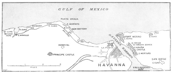
The Spanish-American War: the defences of Havana.....
HRM26A14_260
The accident to a Scotch Express, 1898. Creator: W...
HRM26A19_468
Coastline, Visby. Creator: Swedlund, Per Adolf (Pe...
HRM26A14_259
The accident to a Scotch Express, 1898. Creator: W...
HRM26A13_311
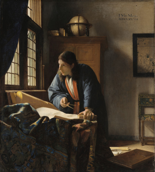
The Geographer, 1669. Creator: Jan Vermeer.
HRM26A14_262
The accident to a Scotch Express, 1898. Creator: W...
HRM26A14_261
The accident to a Scotch Express, 1898. Creator: W...
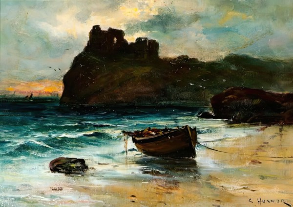
HRM26A10_420
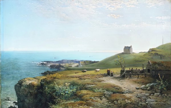
Seascape with Castle, c1870-1900. Creator: Colin H...
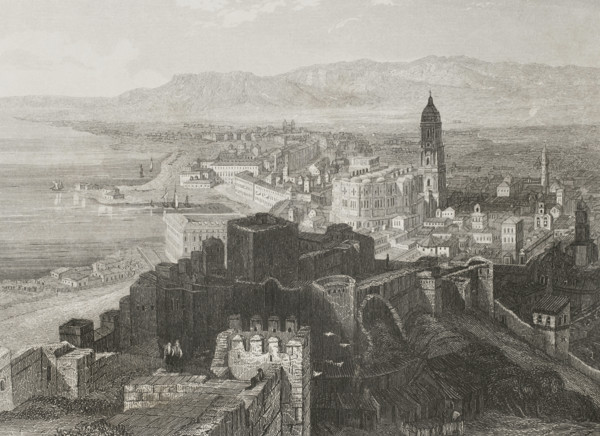
HRM26A21_108
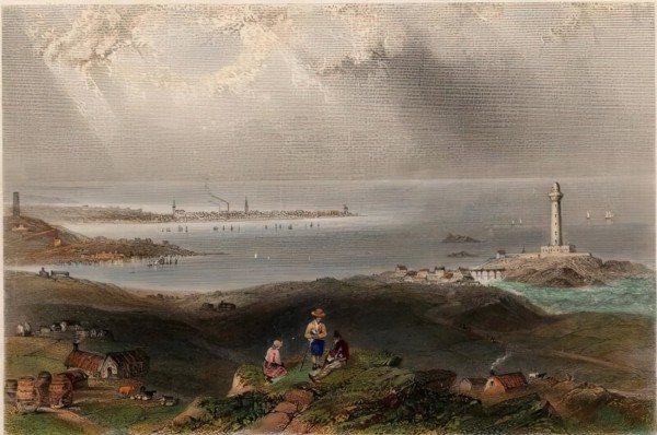
Panoramic view of the city of Malaga, Andalusia, S...
HRM26A20_427
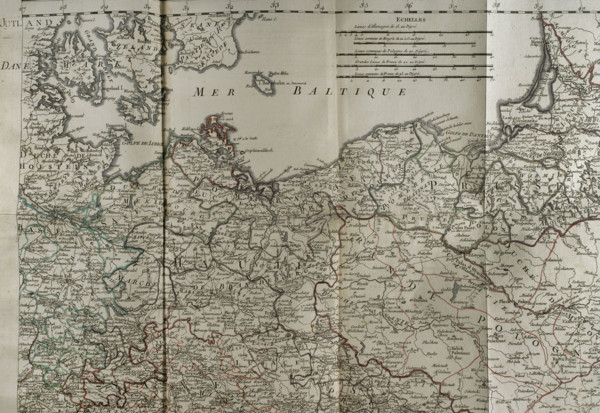
Map of the Baltic Sea coast, Prussia and Poland - ...
HRM26A16_476
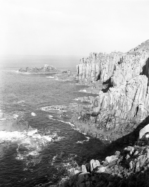
Land's End, Cornwall, c1955. Creator: Arthur Charl...
HRM26A10_307
Peterhead, (View from the South showing Lighthouse...
HRM26A16_475
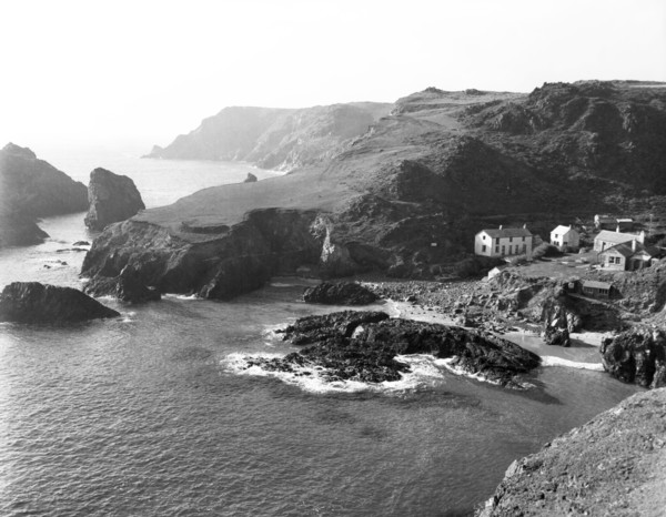
Kynance Cove, Cornwall, c1955. Creator: Arthur Cha...
HRM26A06_149
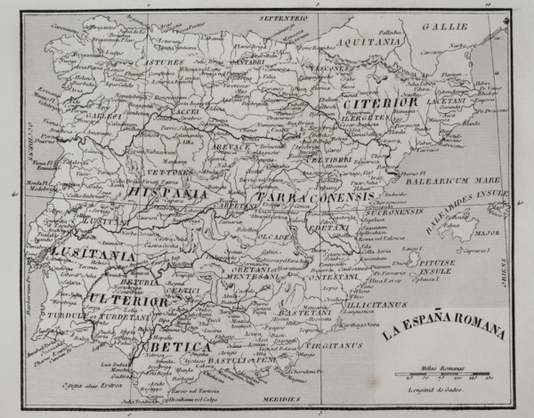
Map of Roman Hispania, 1852. Creator: Unknown.
HRM26A04_009
At Cove, 1861. Creator: James Cassie.
HRM26A04_138
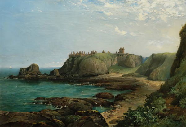
Dunnottar Castle, 1857. Creator: James Cassie.
HRM26A03_474
A Sunny Day in Winter, c1878. Creator: Allan James...
HRM26A04_051
On the Bents, Aberdeen, 1873. Creator: Archibald D...
HRM26A03_171
Wick, c1815. Creator: William Daniell.
HRM26A05_360
View looking north-east of Shanklin Beach, showing...
HRM26A05_406
View looking north-east from Shanklin Beach, showi...
HRM26A04_499
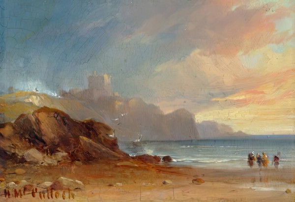
Seascape with Castle and Figures, 1850. Creator: H...
HRM26A03_277
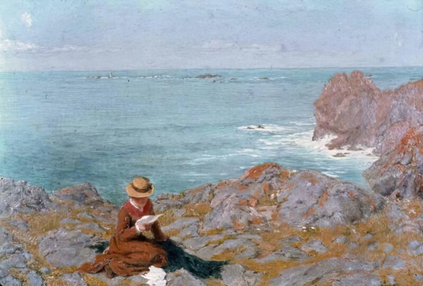
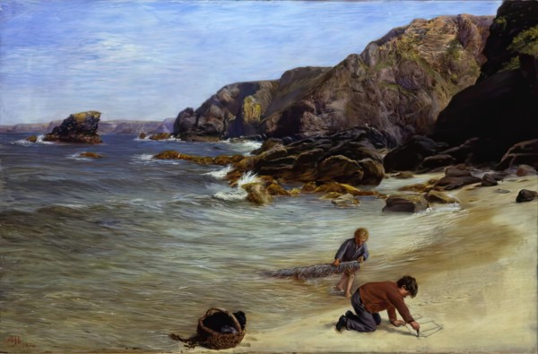
Early Efforts, 1874. Creator: Allan James Hook.
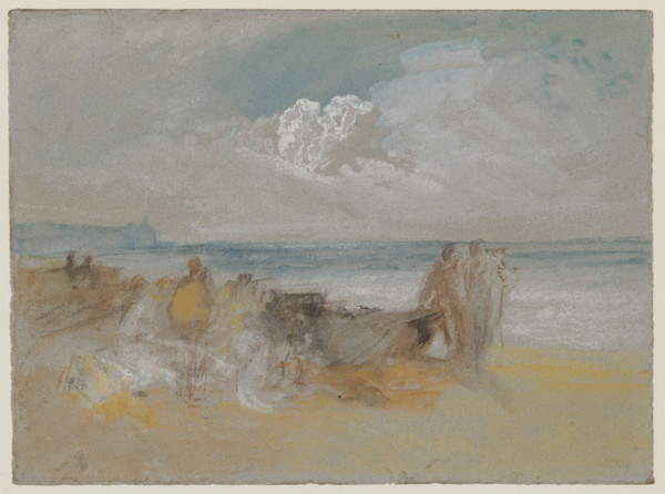
HRM25A55_382
Beacon Light, 1835-1845. Creator: JMW Turner.
HRM25A58_039
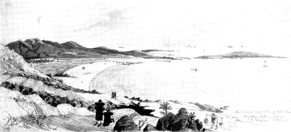
Heligoland, the island to be ceded to Germany, 189...
HRM25A55_383
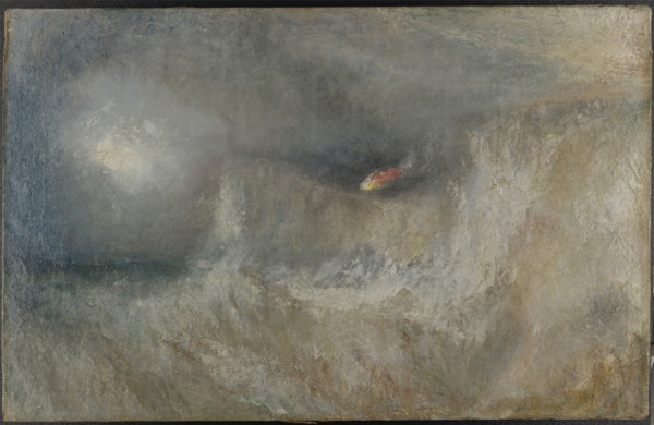
The Morning After the Storm, 1840-1845. Creator: J...
HRM25A58_038
Map showing the position of Heligoland, 1890. Crea...
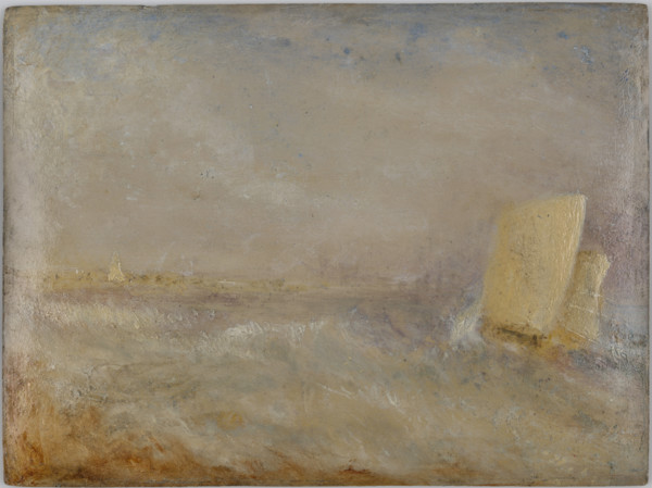
HRM25A55_384
A Sailing boat off Deal, c1835. Creator: JMW Turne...
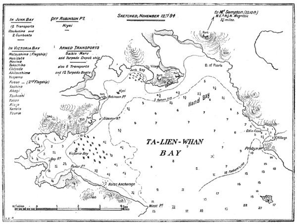
HRM25A58_085
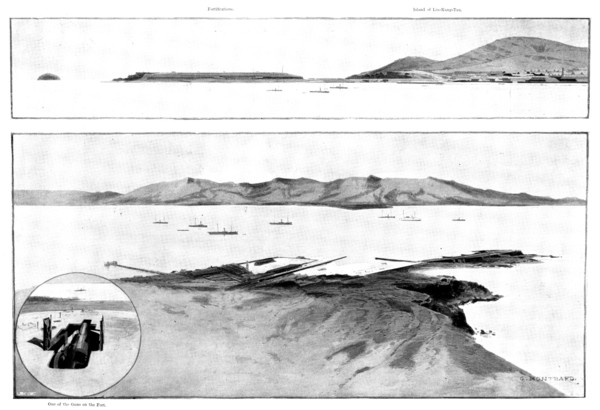
Plan of Ta-Lien-Whan Bay, captured by the Japanese...
HRM25A55_385
The Morning After the Wreck, c1840. Creator: JMW T...
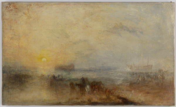
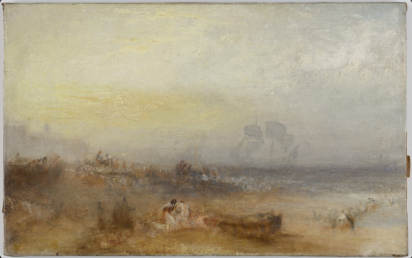
HRM25A55_381
Margate, 1840s. Creator: JMW Turner.

HRM25A55_216
Second Cliff House (1896-1907) Hotel, San Francisc...
HRM25A47_036
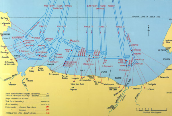
Naval Bombardments on D-Day, Second World War. Cr...
HRM25A44_443
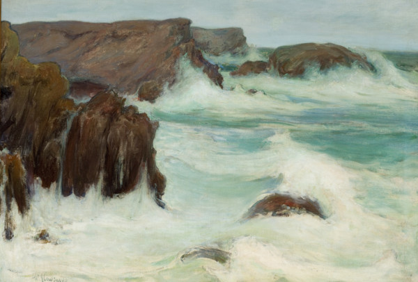
The Sea in Brittany, 1904. Creator: Wladyslaw Slew...
HRM25A38_290
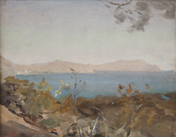
Sudak, 1904. Creator: Jan Ciaglinski.
HRM25A38_294
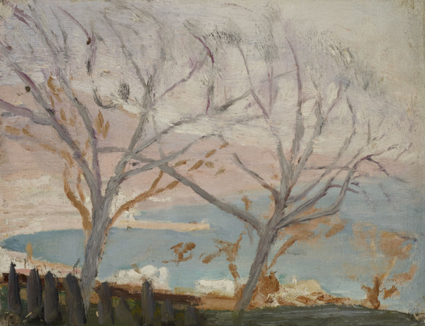
Yalta (Spring), 1904. Creator: Jan Ciaglinski.
HRM25A41_003
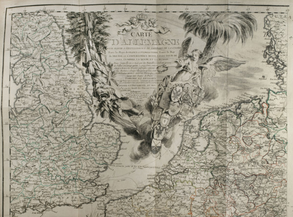
Map of Germany showing war of 1755 to 1763 (Seven ...
HRM25A41_042
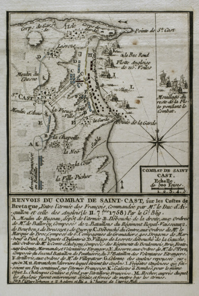
Seven Years War (1756-1763): Battle of Saint-Cast ...
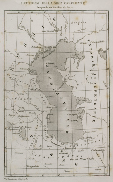
HRM25A41_343
Caspian Sea coast, 1839. Creator: Thunot Duvotena...
HRM25A38_220
Mediterranean Landscape, 1892. Creator: Heinrich G...
HRM25A23_310
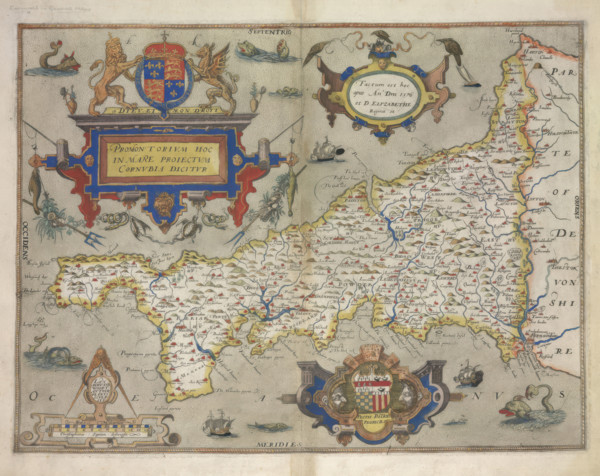
Map of Cornwall, 1579. Creator: Christopher Saxto...
HRM25A26_338
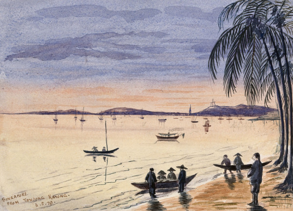
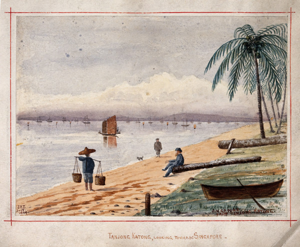
Singapore: view towards Singapore from the beach a...
HRM25A26_337
Singapore: view along the beach by Singlap, 1879. ...
HRM25A23_395
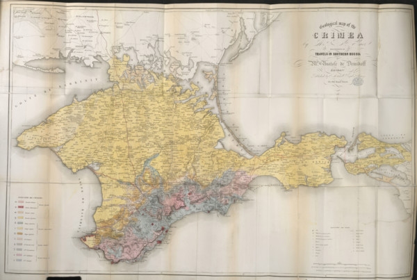
Geological map of the Crimea, 1853. Creator: Unkno...
HRM25A26_346
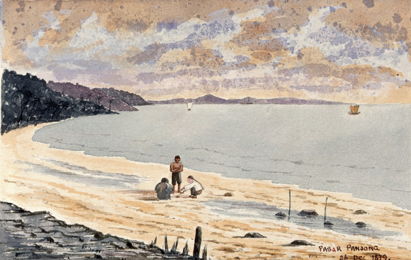
Singapore: a view along the beach at Pasar Panjong...
HRM25A26_333
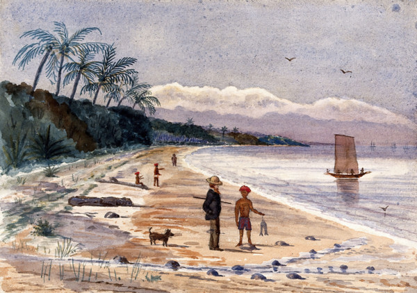
Singapore: view from the beach at Tanjong Katong, ...
HRM25A23_489
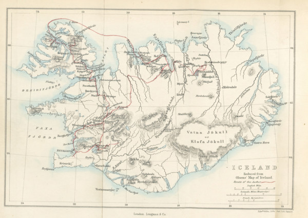
Iceland, Reduced from Olsens' Map of Iceland, 1867...
HRM25A23_436
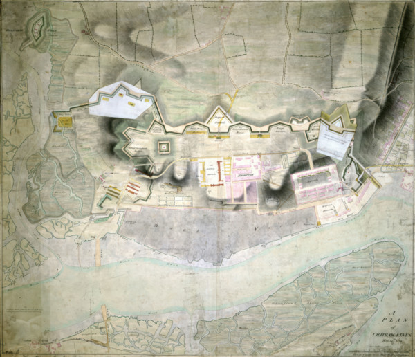
A Plan of Chatham Lines, May 18th 1804. Creator: ...
HRM25A14_481
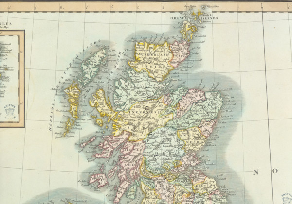
Map of Scotland, (c1800?). Divided into counties, ...
HRM25A15_102
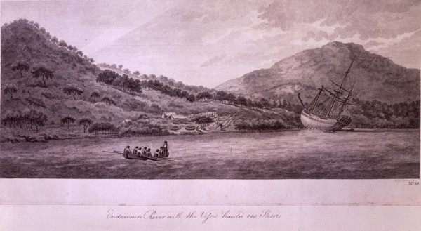
Endeavours River with the Vessel hauled on the Sho...
HRM25A15_426
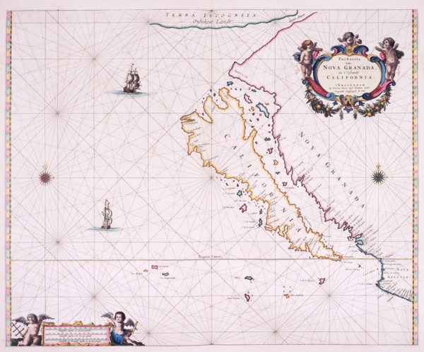
Map of California, 1666. 'Paskaerte Van Nova Grana...
HRM25A14_480
Detail from a map of Scotland, (c1800?). Showing s...
HRM25A14_491
Map of Mexico, 1567. Mexico, conquered by the Span...
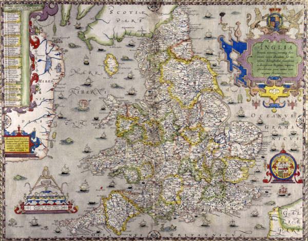
![Map of Great Britain and Ireland, c1564-c1570. 'A general description of England & Irelad [sic]](https://lres.photo12.com/lo/t-hrm25a14_268.jpg)
HRM25A14_268
Map of Great Britain and Ireland, c1564-c1570. 'A ...
HRM25A15_101
Map of the British Colonies in North America, c177...
HRM25A15_425
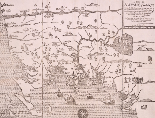
Map of New England, 1677. Self-proclaimed as the f...
HRM25A14_485
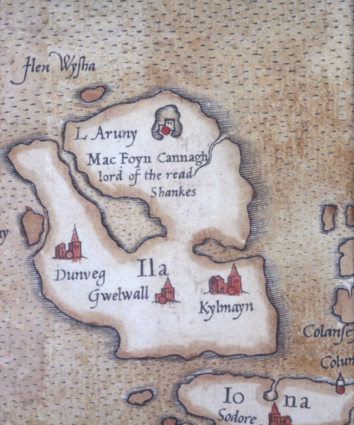
The island of Islay, 1564. 'L Aruny, Mac Foyn Cann...
HRM25A15_420
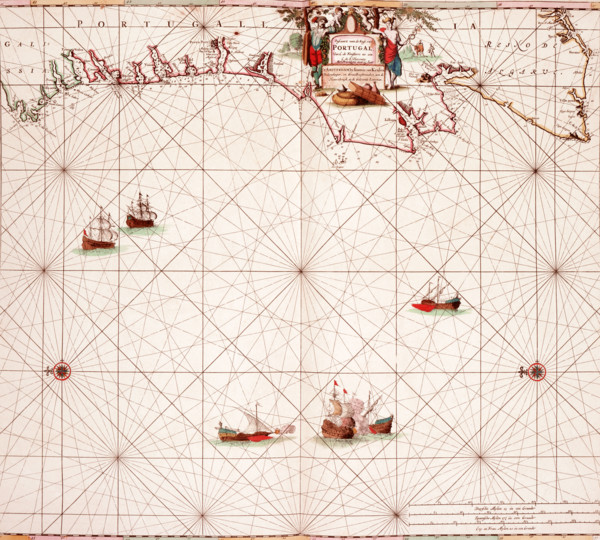
Map of the Atlantic coast of Portugal, 1682. 'Pasc...
HRM25A14_277
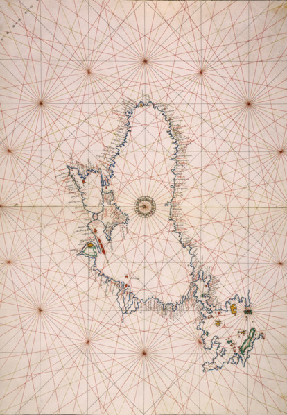
Map of the Black Sea coastline, 1536. The coast of...
HRM25A14_378
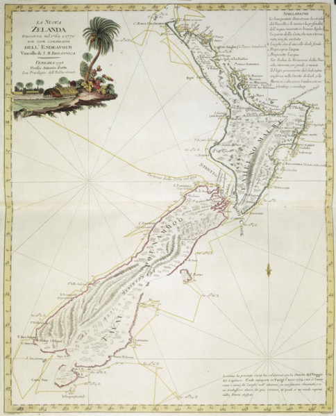
Map of New Zealand, 1778. 'La Nuova Zelanda trasco...
HRM25A14_486
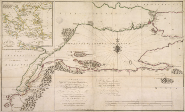
Map of the Sea of Marmara, 1770. The sea of Marmar...
HRM25A15_103
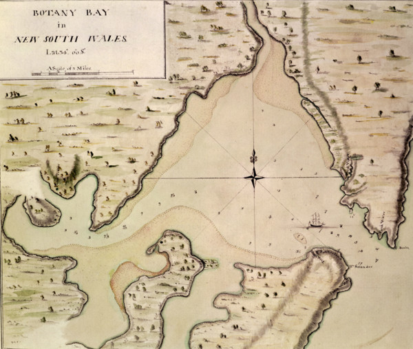
Map of Botany Bay, New South Wales, Australia, 177...
HRM25A15_419
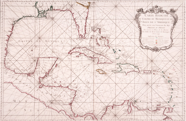
Map of the Gulf of Mexico, 1772. 'Carte Reduite du...
HRM25A15_422
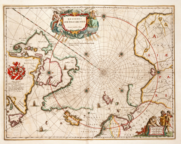
Map of the Arctic, 1662. 'Regiones sub Polo Arctic...
HRM25A14_473
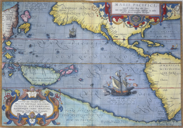
The Pacific Ocean, 1586. 'Maris Pacifici'. A map s...
HRM25A15_421
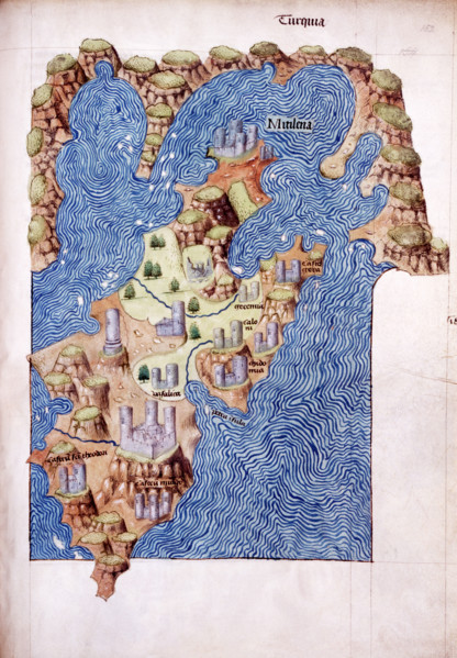
Mitilena (Lesbos), c1485. Mytilene is the capital ...
HRM25A14_274
World Map, 1562. The map suggests that North Ameri...
HRM25A14_497
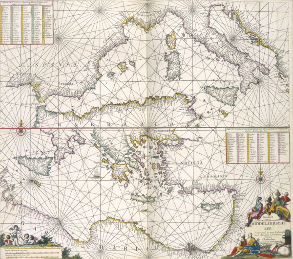
Maps of the Mediterranean, 1682. The upper half is...
HRM25A14_260
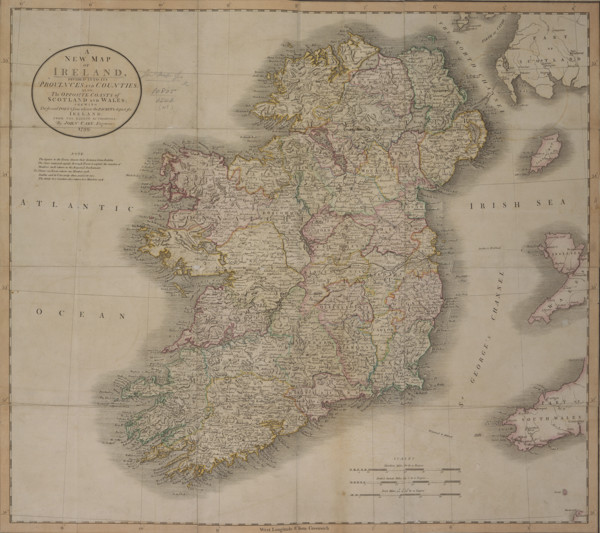
'A New Map of Ireland', 1799. 'A New Map of Irelan...
HRM25A14_488
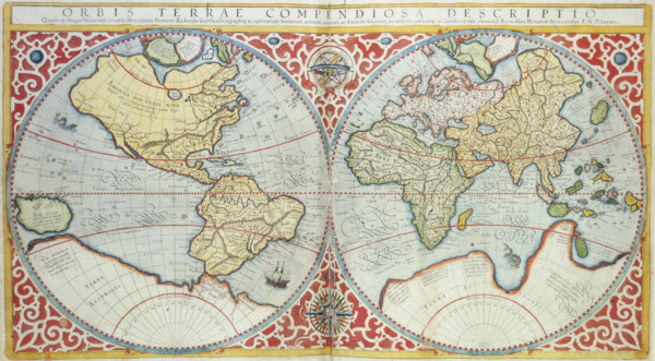
World Map, 1587. 'Orbis terrae compendiosa descrip...
HRM25A15_417
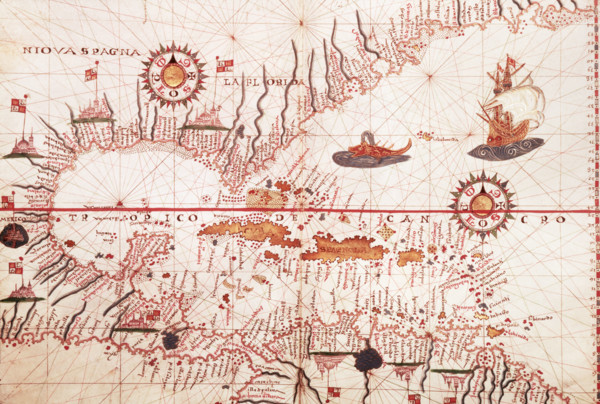
Map of the Caribbean, c1578. Showing 'Niova Spagna...
HRM25A15_430
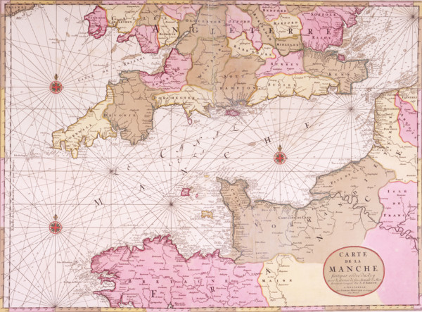
Map of the English Channel, 1693. 'Carte de la Man...
HRM25A14_468
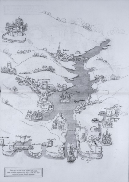
A map of Dartmouth Haven, Devon, 1806. 'From a Cha...
HRM25A15_418
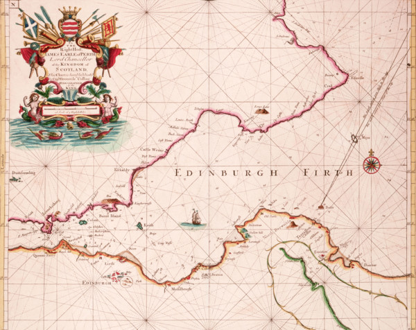
Map of the Firth of Forth, 1689. The first British...
HRM25A15_427
Map of the River Humber and land between Hull and ...
HRM25A14_263
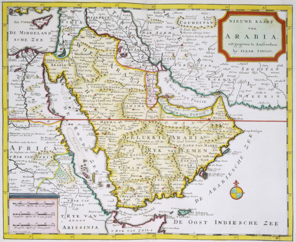
Map of Arabia, 1744. 'Nieuwe Kaart van Arabia. uit...
HRM25A14_382
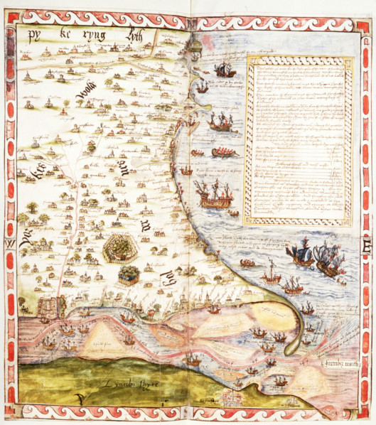
Top half of Lord Burghley's chart of the Humber, 1...
HRM25A15_432
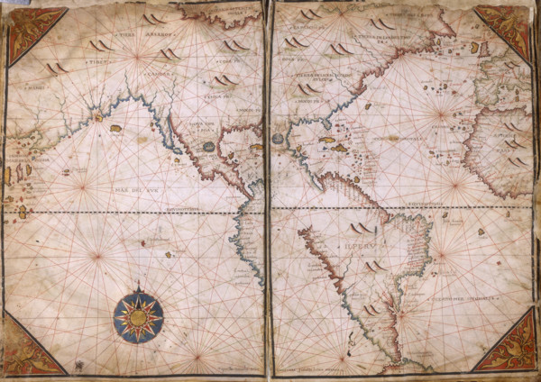
Map of Europe, 1570. The traditional portolan char...
HRM25A15_332
A map of England and Wales, 1583. The various main...
HRM25A10_287
Sunset on the Lake, 1907. Creator: Lendall Pitts.
HRM25A10_179
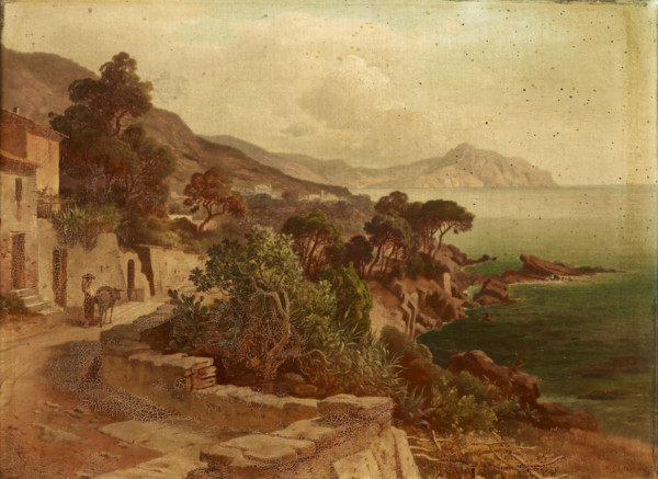
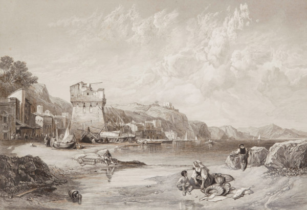
Vietri, Gulf of Salerno, 1859. Creator: William Mi...
HRM25A03_316
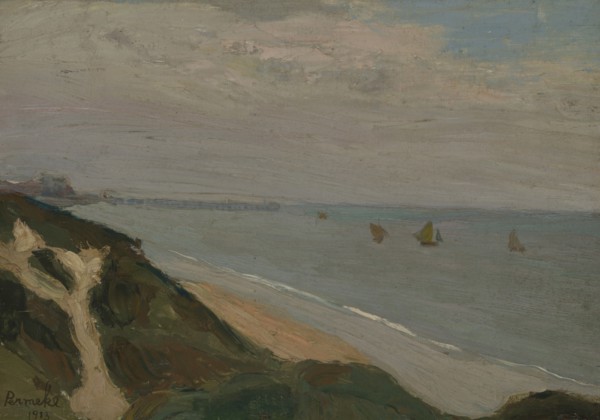
Seascape, 1913. Creator: Constant Permeke.
HRM25A02_379
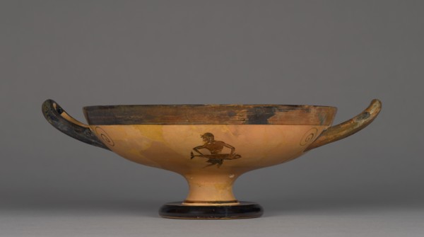
Attic Black-Figure Kylix, about 525-500 BC. Creato...
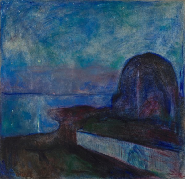
HRM24A63_123
Starry Night, 1893. Creator: Edvard Munch.
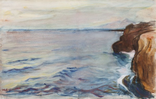
HRM24A58_222
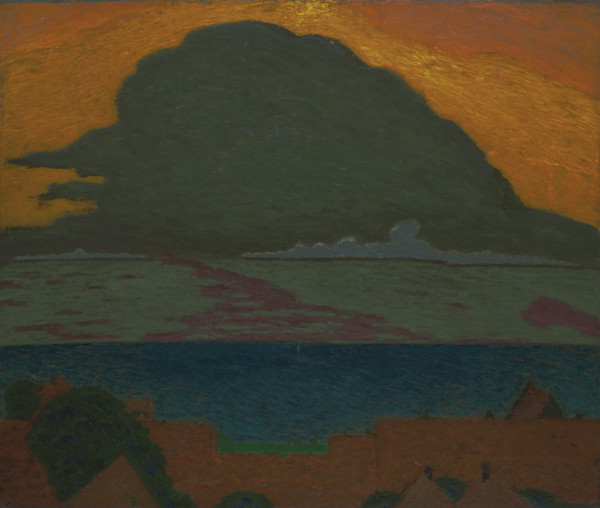
Seaside Landscape, 1905. Creator: Magnus Enckell.
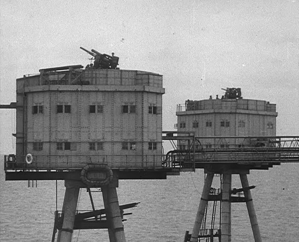
HRM24A38_102
Anti-Aircraft Guns on a British Maunsell Army Fort...
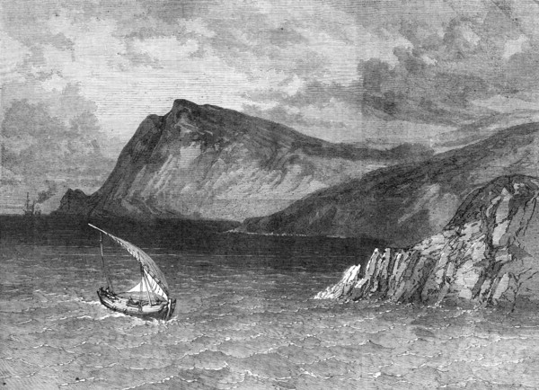
HRM24A34_379
North coast of Crete, from the sea, 1869. Creator:...
HRM24A26_198
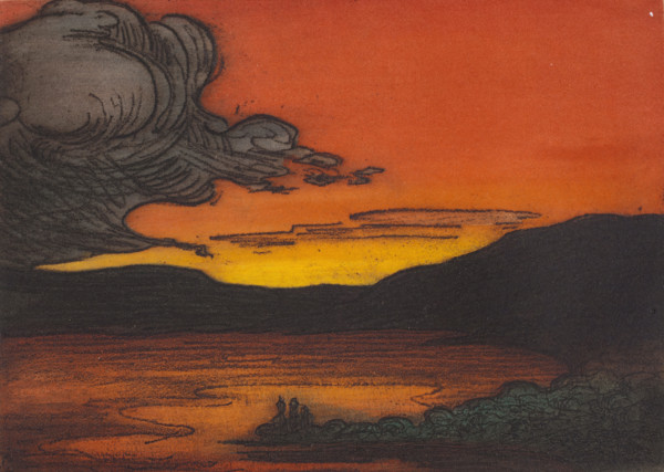
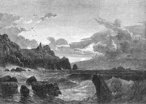
The Land's-End: Sunset Before A Stormy Night by S....
HRM24A25_472
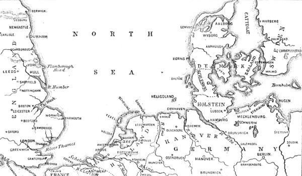
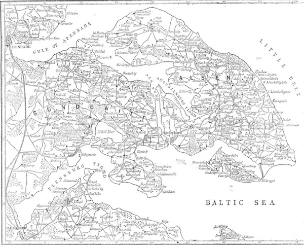
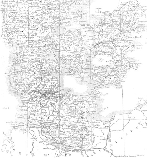
The seat of war in Denmark, 1864. Creator: Unknown...
HRM24A26_267
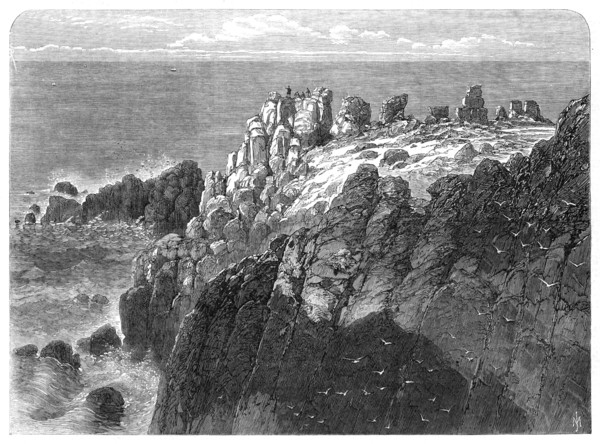
The Prince of Wales at The Land's End, Cornwall, 1...
HRM24A24_217
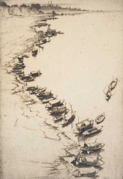
The evening river. From: Fourth Indian plates, 192...
HRM24A15_057
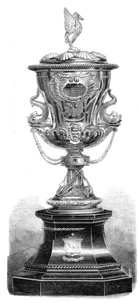
Testimonial to Capt. Inglefield, R.N., from the Me...
HRM24A15_022
The seat of war in Denmark, 1864. Creator: John Do...
- Page
-
- sur
- 7