Catégorie
Orientation
Licence
Couleur
Âge
Nb de personnes
Collections
Période
3292 résultats pour : map
Page sur
/
33
Connectez-vous pour plus de résultats
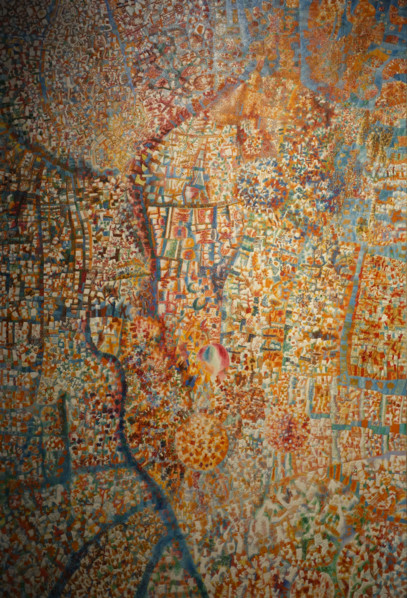
UMG26A24_301
Formula of Spring
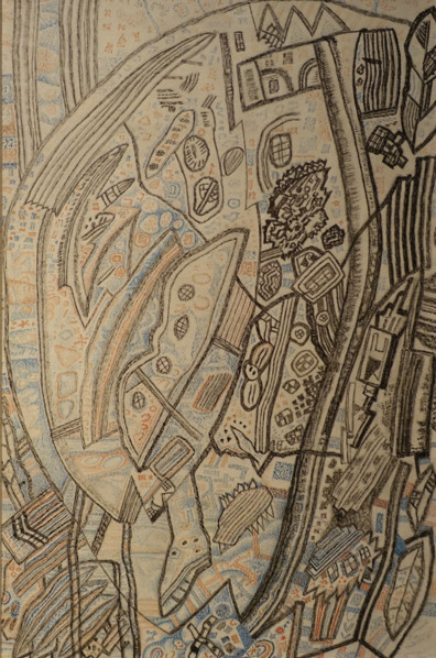
UMG26A24_285
Landscape

UMG26A22_124
Portrait of Prince Platon Alexandrovich Zubov (176...
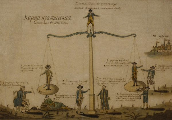
UMG26A23_325
Critical Map
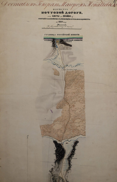
UMG26A23_180
Route map of the postal road from Kyakhta (Republi...
UMG26A25_264
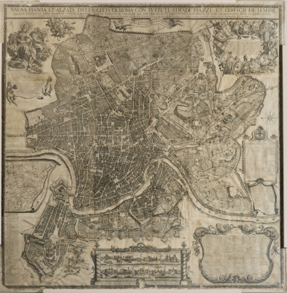
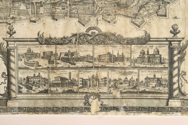
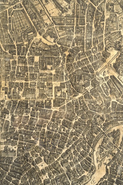
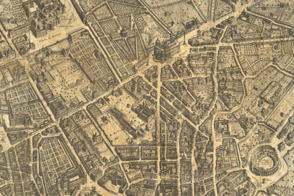
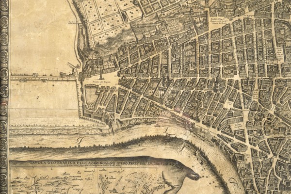
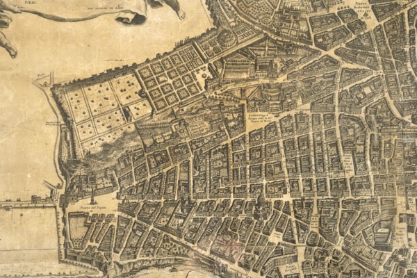
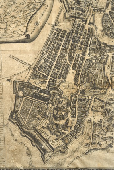
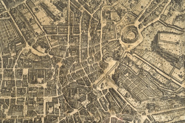
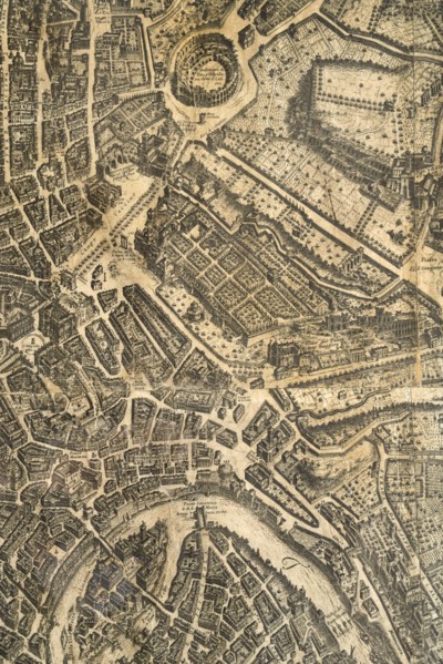
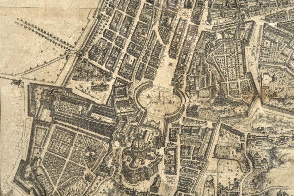
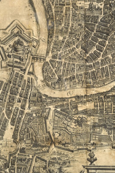
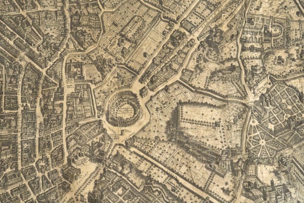
Map of the city of Rome, year 1756, Giovan Battist...
UMG26A25_275
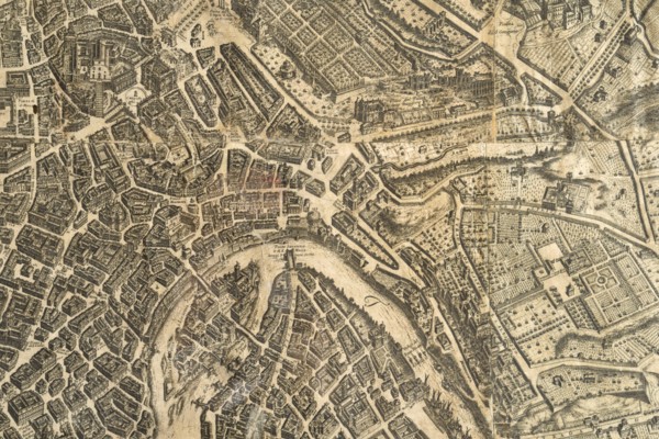
Map of the city of Rome, year 1756, Giovan Battist...
UMG26A25_289
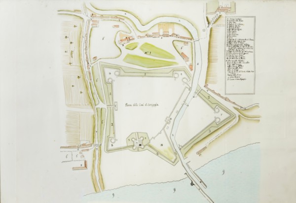
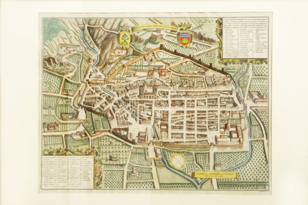
Pianta della cittv† di Senigaglia, proveniente dal...
UMG26A25_265
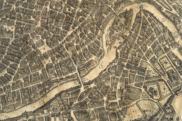
Map of the city of Rome, year 1756, Giovan Battist...
UMG26A25_274
Map of the city of Rome, year 1756, Giovan Battist...
UMG26A25_290
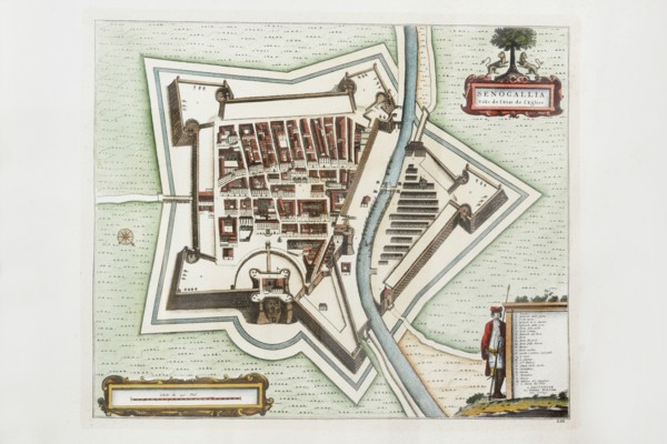
Pierre Mortier, map of Senogallia Ville de l'Etat ...
UMG26A25_273
Map of the city of Rome, year 1756, Giovan Battist...
UMG26A25_272
Map of the city of Rome, year 1756, Giovan Battist...
UMG26A25_268
Map of the city of Rome, year 1756, Giovan Battist...
UMG26A25_285
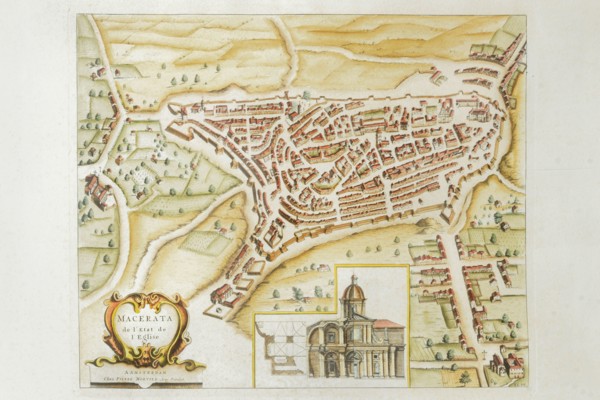
Pierre Mortier, Map of Macerata de l'Etat de l'Egl...
UMG26A25_269
Map of the city of Rome, year 1756, Giovan Battist...
UMG26A25_286
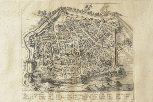
Pierre Mortier, map of Pisaurum vulgo Pesaro de l'...
UMG26A25_266
Map of the city of Rome, year 1756, Giovan Battist...
UMG26A25_277
Map of the city of Rome, year 1756, Giovan Battist...
UMG26A25_287
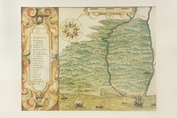
Map of the territories of Sinigallia, 17th century...
UMG26A25_267
Map of the city of Rome, year 1756, Giovan Battist...
UMG26A25_276
Map of the city of Rome, year 1756, Giovan Battist...
UMG26A25_270
Map of the city of Rome, year 1756, Giovan Battist...
UMG26A25_271
Map of the city of Rome, year 1756, Giovan Battist...
UMG26A25_284
Pierre Mortier, map of Gubbio, ancient royal city ...
UMG26A25_283
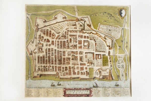
Joan Blaeu, Fanum Fortunae historical map of the c...
UMG26A25_294
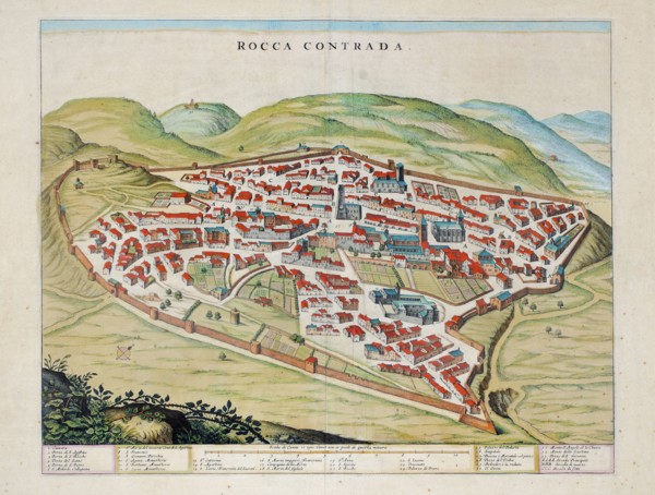
Rocca Contrada, current Arcevia, historical map of...
UMG26A25_306
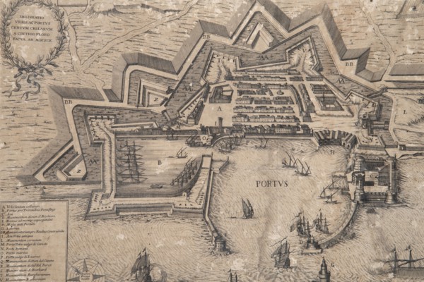
Historical engraving depicting the port and the ci...
UMG26A25_293
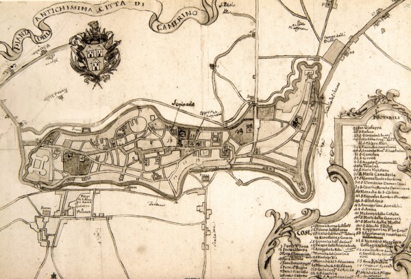
Camerino, 17th century historical map of the city,...
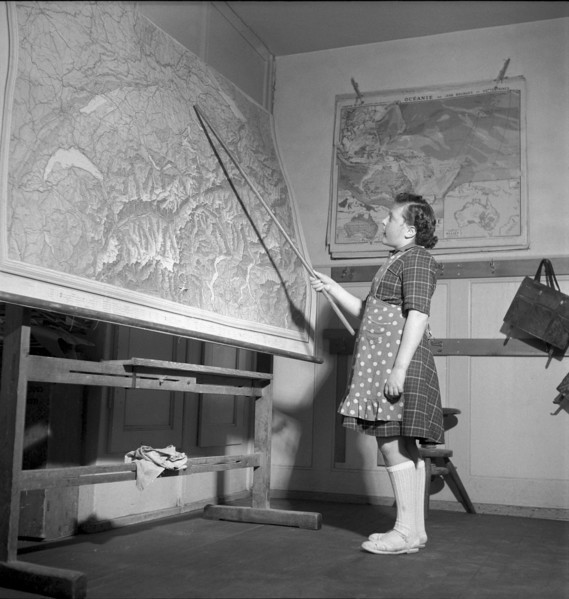
UMG26A13_305
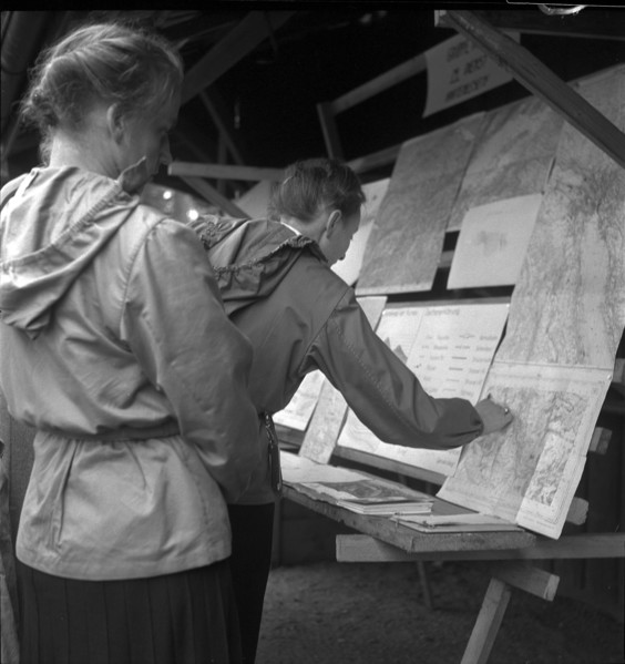
Schoolgirl during geography lesson, La Brevine, 19...
UMG26A11_313
Napoleon I Bonaparte (1769-1821). Consul for Life ...
UMG26A11_334
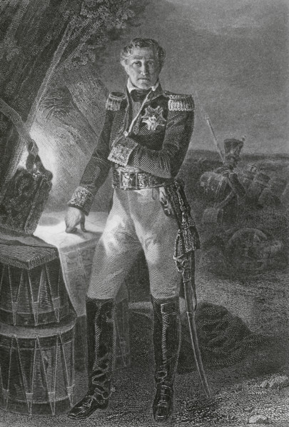
Laurent de Gouvion-Saint-Cyr (1764-1830). French m...
UMG26A11_354
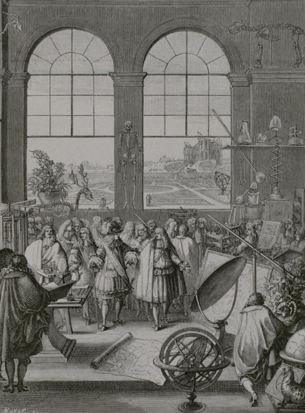
Paris, France. King Louis XIV (1638–1715) and his ...
UMG26A11_319
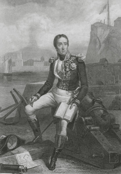
Etienne Eustache Bruix (1759-1805). French Navy ad...
UMG25A41_226
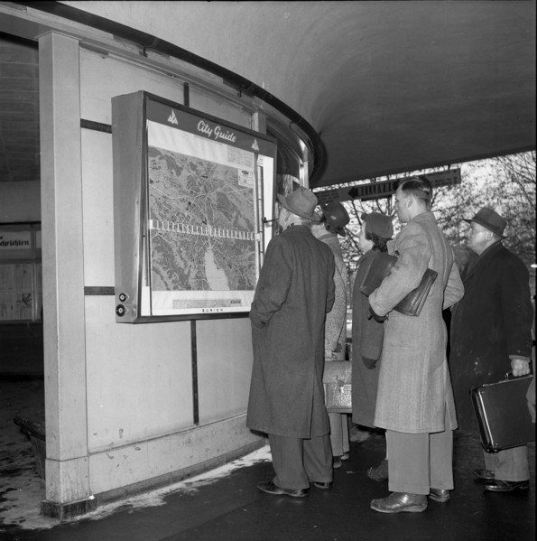
City guide in Zurich, city map, 1954.
UMG25A35_321
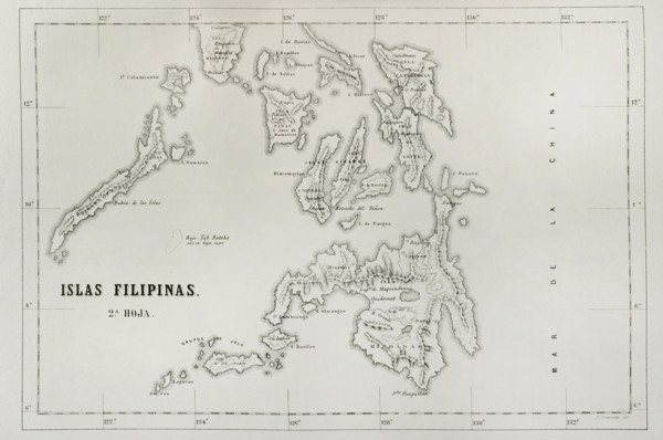
Map of the Philippine islands (Spanish colonial pe...
UMG25A35_307
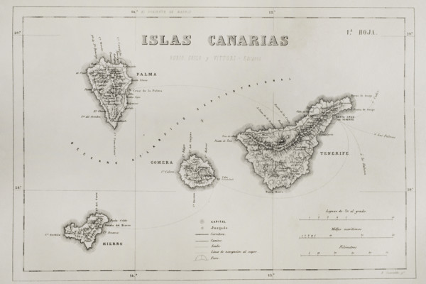
History of Spain. Map of the Canary Islands. Islan...
UMG25A35_305
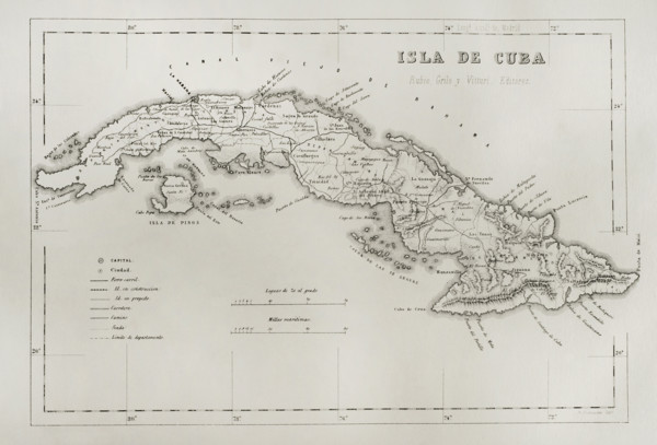
Map of the Island of Cuba (Spanish colonial period...
UMG25A35_312
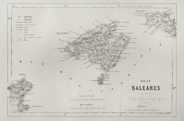
History of Spain. Map of the Balearic Islands. Eng...
UMG25A31_298
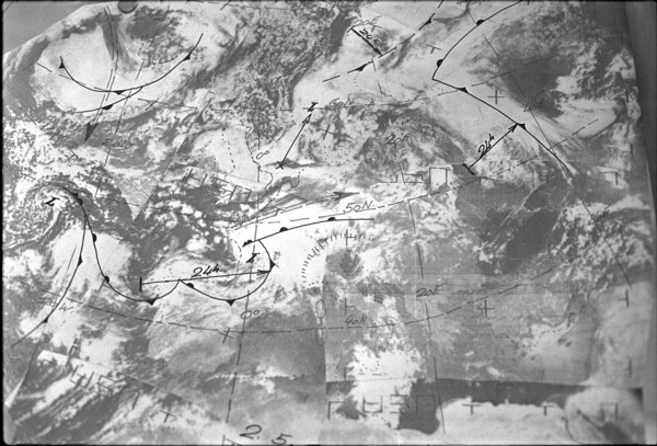
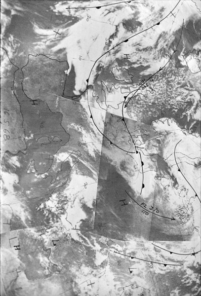
Weather map 1968.

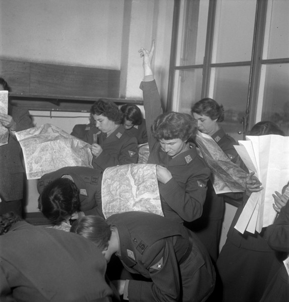
UMG25A30_245
Women military drivers at theoretical training, Br...
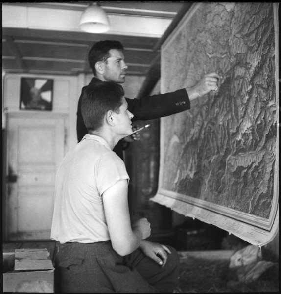
UMG25A28_080
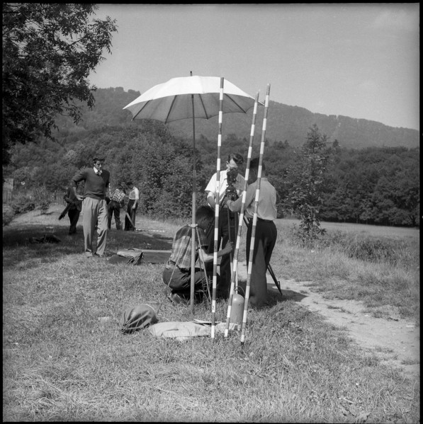
Geodesy-students at surveying exercise, ETH Zurich...
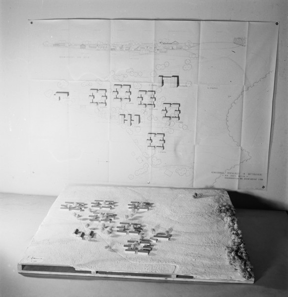
UMG25A28_171
Map and model of Pestalozzi Children's Village 194...
UMG25A24_085
Polish internees look at a map of Switzerland; 194...
UMG25A27_387
28.7.-5.8. Operation K 659: For the first time, Sw...
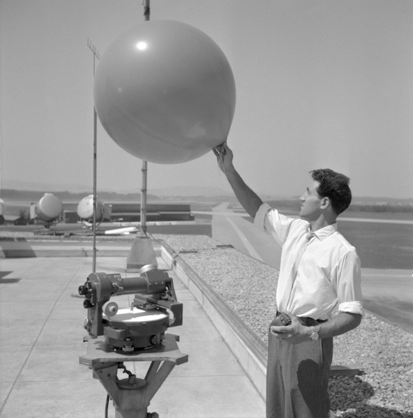
UMG25A29_164
Airport weather service, weather baloon, Zurich-Kl...
UMG25A18_090
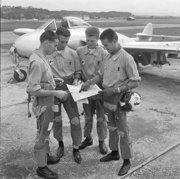
Military pilots study tactical exercise, Dübendorf...
UMG25A21_260
Auxiliary troops; women reading a map; 1942
UMG25A27_381
28.7.-5.8. Operation K 659: For the first time, Sw...
UMG25A08_200
Ricardo Bonetti, radiesthesist, in Blick editorial...
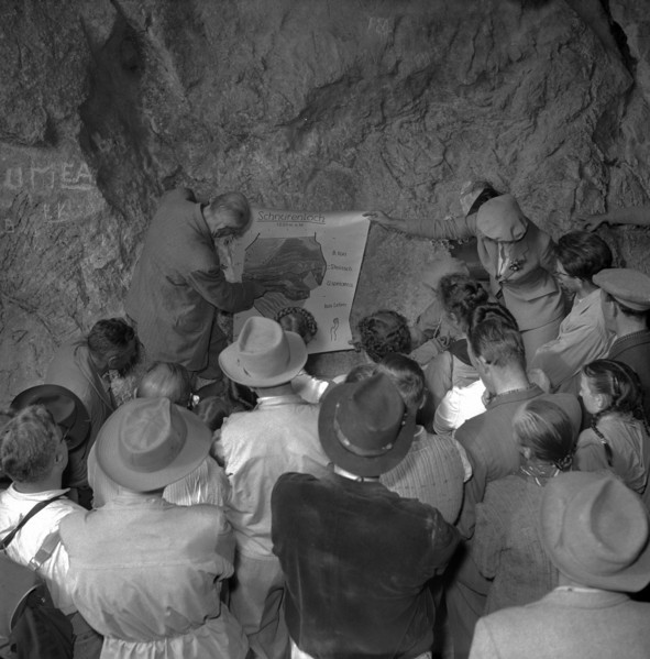
UMG25A13_264
Map of the Schnurenloch grotto in the Simmental, 1...
UMG25A10_193
Women soldiers training map reading, Lucerne 1950.
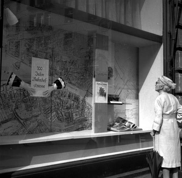
UMG25A10_283
Shop window Ringier publisher: 100 years Bahnhofst...
UMG25A11_122
Airport weather service, weather map, Zurich-Klote...
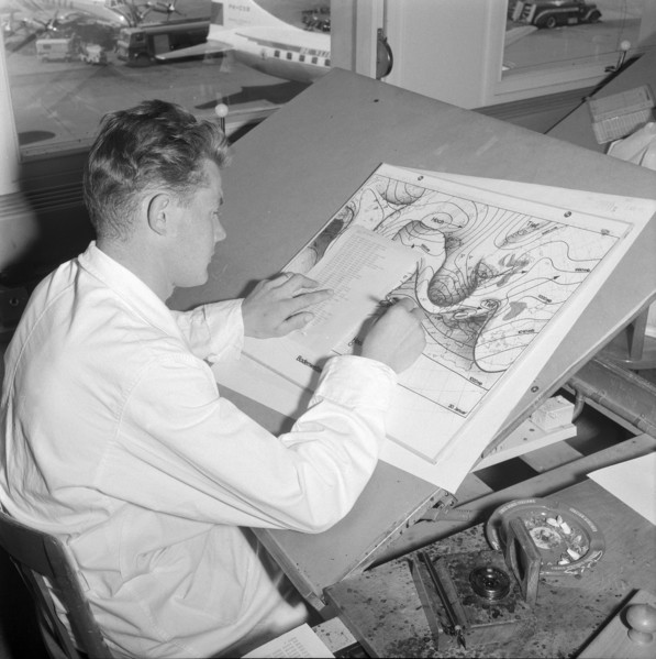
UMG25A15_389
Weather map 1968
UMG25A05_408
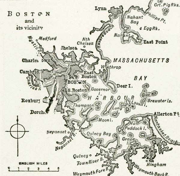
This map dates to 1922 and shows Boston and its vi...
UMG25A05_353
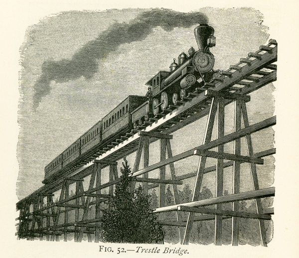
This illustration dates to the 1870s and shows a t...
UMG25A06_238
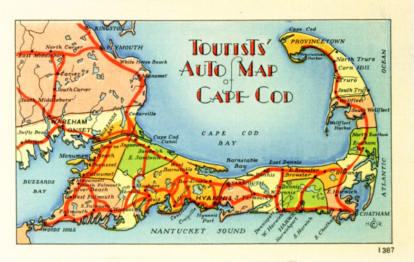
Tourists' Auto Map of Cape Cod.
UMG25A06_183
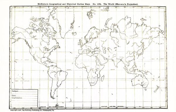
This geographical and historical outline map shows...
UMG25A06_170
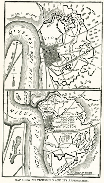
This map dating to late 1800s shows Vicksburg and ...
UMG25A06_171
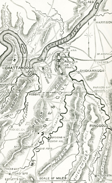
Shown here is a map of the Chickamauga and Chatta...
UMG25A06_181
This geogrpahical and historical outline maps show...
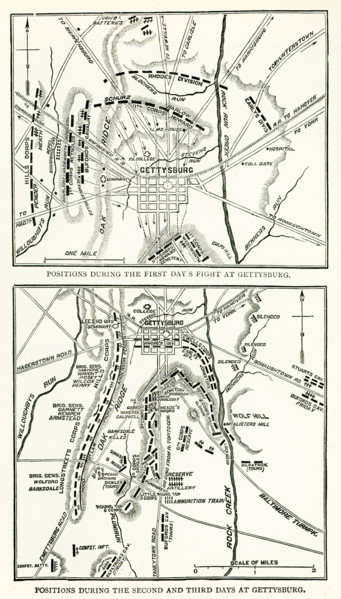
UMG25A06_168
The Battle of Gettysburg was fought July 1-3, 1863...
UMG25A05_438
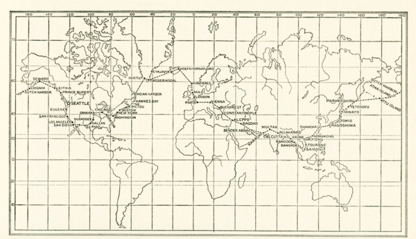
The image dates to the early 1920s. Around the wor...
UMG25A05_103
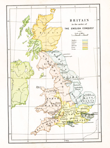
This map shows Britain at the time when it was in ...
UMG25A05_104
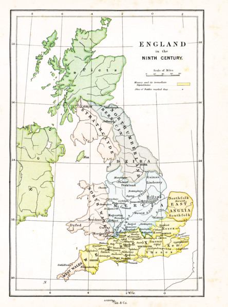
This map shows Britain in the 9th century A.D. The...
UMG25A06_054
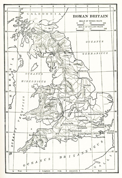
Map Roman Britain. The Province of Britain (Britan...

UMG25A06_052
Map of Africa in 1910. Note: The coloring shows t...
UMG25A06_043
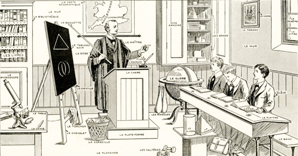
French Lesson in Pictures - The names of familiar ...
UMG25A06_053
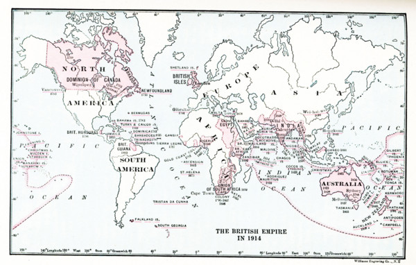
Map of British Empire in 1914.
UMG25A06_055
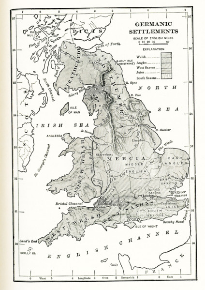
Germanic Settlements in England. This map shows Ge...
UMG25A05_450
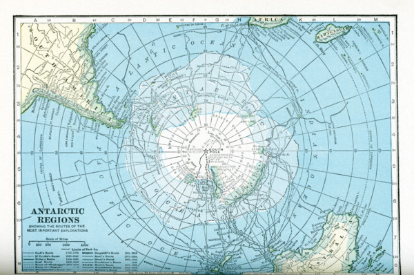
This map dates to the 1920s and shows the Antarcti...
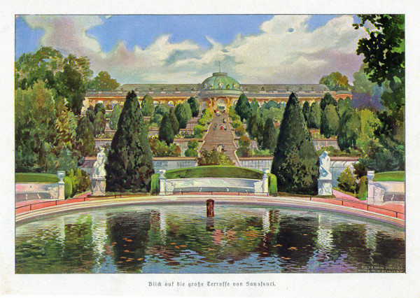
UMG25A05_052
View at Sanssouci
UMG25A06_186
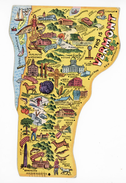
This Vermont-state-shaped postcard dates to 1948.
UMG25A06_184
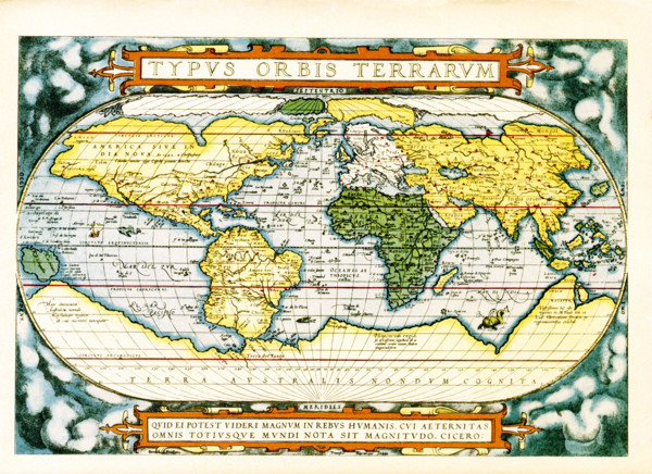
The text at the top of this world map by Abraham O...
UMG25A06_178
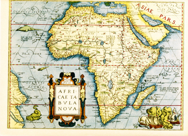
Map of Africa - the inset in lower left titles it:...
UMG25A06_179
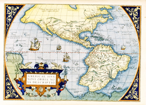
Abraham Ortelius's map of the Americas, Americae s...
UMG25A05_102
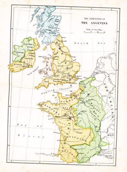
This map shows the dominions of the Angevins in Br...
UMG25A06_180
This geographical and historical outline map shows...
UMG25A05_137
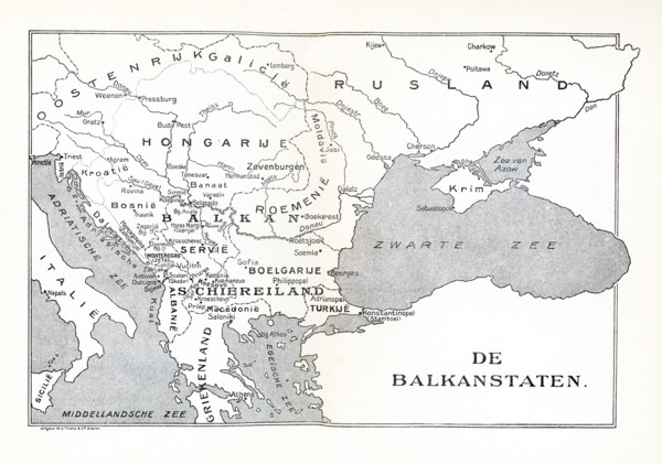
This map shows the Balkan States in 1921. The map ...
UMG25A06_182
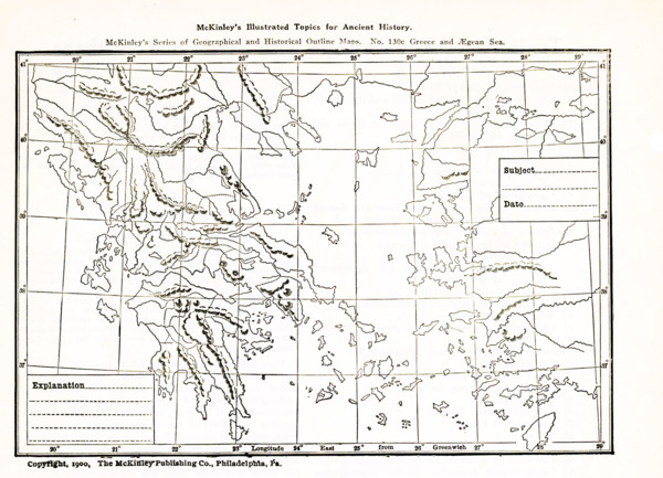
This geographical and historical outline map focus...
UMG25A06_056
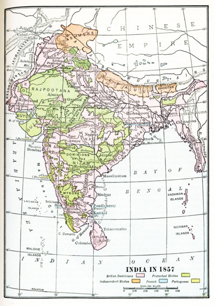
India in 1857. British dominions are in pink. Prot...
UMG25A01_165
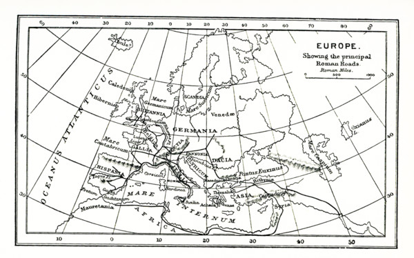
This map of europe shows the principal ancient Rom...
UMG25A01_169
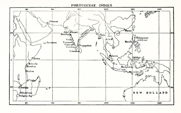
This map shows the Portuguese exploits in the Indi...
UMG25A01_164
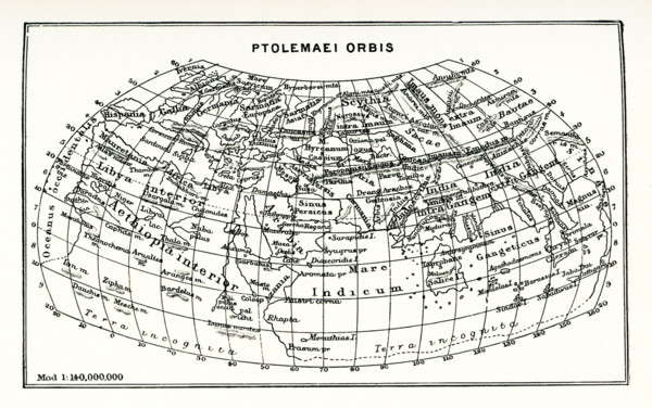
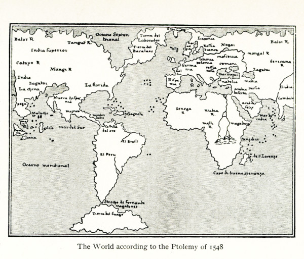
This map shows the world according to Ptolemy. The...
UMG25A01_168
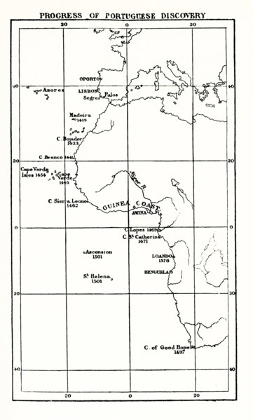
This map shows the progress of Portuguese discover...
UMG25A01_156
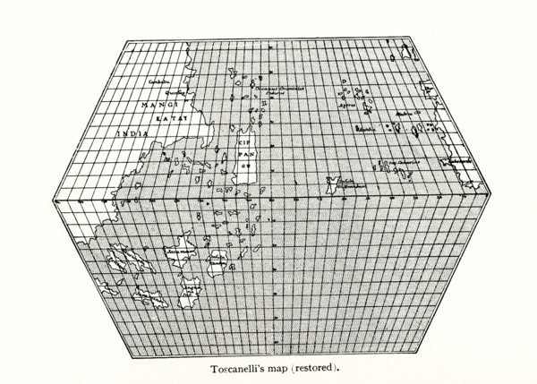
Toscanelli’s Map (Restored). Toscanelli (1397 –14...
UMG25A01_182
This Babylonian/Chaldaean map of the world was dra...
UMG25A01_402
American civil war, us civil war, Charleston harbo...
UMG25A01_157
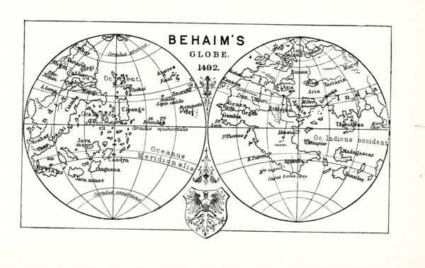
This illustration shows Behaim's globe in 1492. Ma...
UMG25A01_161
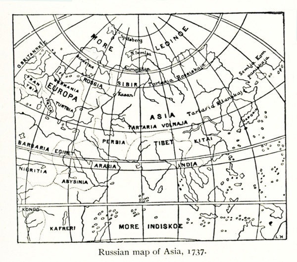
This Russian map shows how they pictured Asia in ...
UMG25A01_162
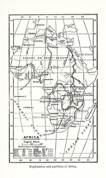
This map shows the exploration and partition of Af...
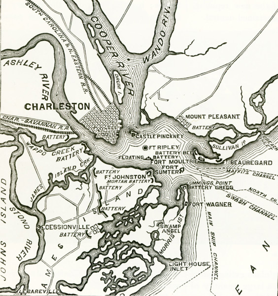
UMG25A01_401
Two forts stand at the entrance of Charleston Harb...
UMG25A01_160
This map by Giacomo Gastaldi (c 1500 – c 1565) was...
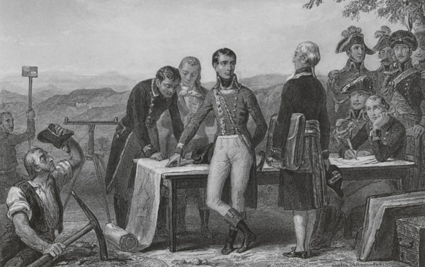
UMG25A00_275
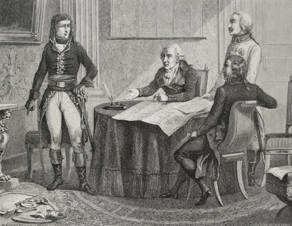
Treaty of Campo Formio. Signed on 17 October 1797 ...
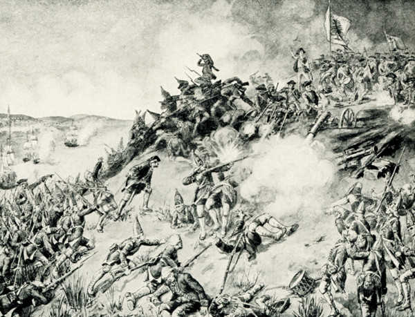
UMG25A00_453
On June 17, 1775, early in the Revolutionary War (...
UMG25A01_204
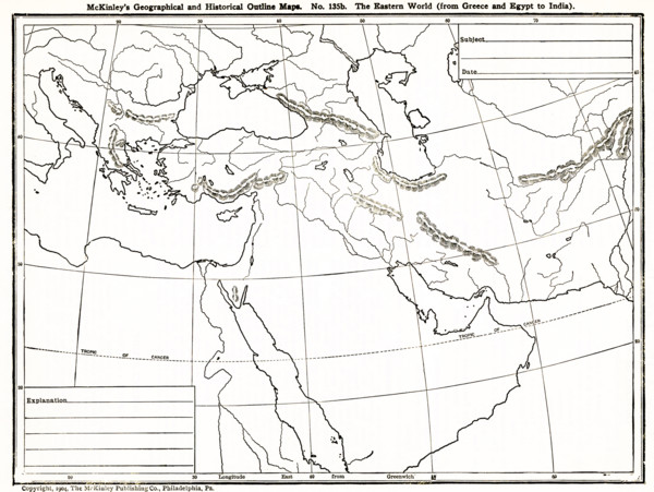
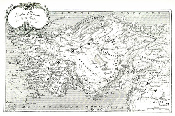
This 1903 illustration shows a map of Asia Minor (...
UMG25A01_210
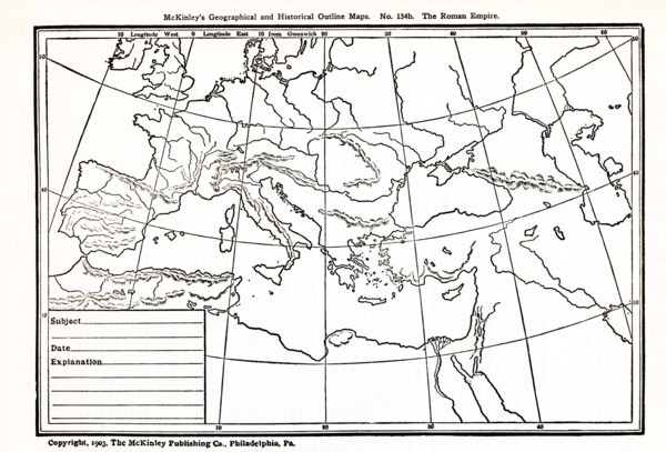
This map, which dates to 1903, delineates the anci...
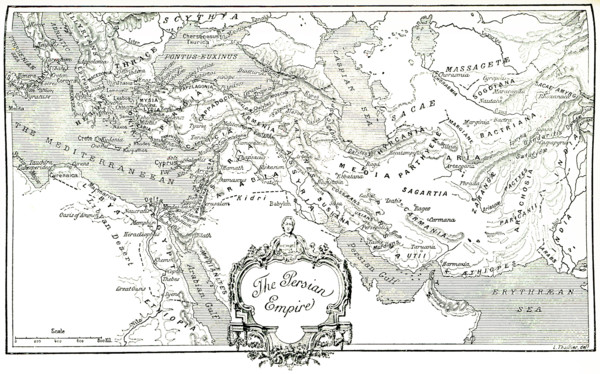
UMG25A01_202
This 1903 illustration shows a map of the eastern ...
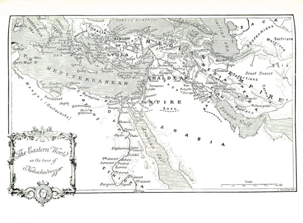
UMG25A01_177
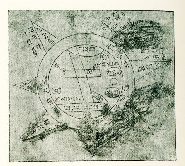
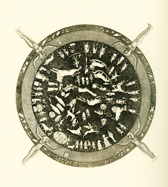
Carved into the ceiling of the portico of a chapel...
Page sur
/
33